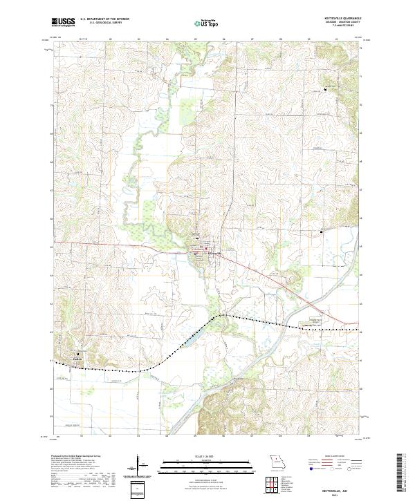
2021 Map of Keytesville
USGS Topo · Published 2021About this map
The Chariton County Courthouse stands as the central landmark of Keytesville, Missouri, marking the civic heart of this agricultural region. The landscape is defined by the winding course of the Chariton River and its various tributaries, including Mussel Fork, Long Cr, and Cottonwood Cr. These waterways create a complex drainage pattern that shapes the rural road network and settlement locations. To the southwest, the town of Dalton is positioned near the wetlands of Horseshoe Lake, illustrating the historic reliance on well-drained ground for township development.
Find a feature on this map
70 named features on this map. Tap any name to fly to it.
Don’t see what you’re looking for? This feature index may not catch every label — zoom into the map to look around manually.
Map Details
Editions of this 2021 Keytesville Map
This is the sole edition of this map. No revisions or reprints were ever made.