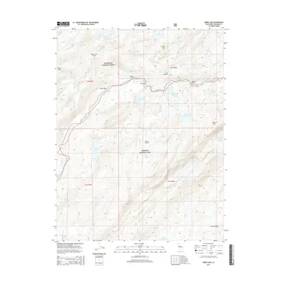
2015 Map of Kibbie Lake
USGS Topo · Published 2015About this map
Yosemite National Park and Stanislaus National Forest share a high-altitude boundary in this 2015 survey, characterized by the glaciated granite of the central Sierra Nevada. The landscape is defined by a dense network of subalpine basins, including Kibbie Lake, Many Island Lake, and Laurel Lake. These water bodies feed into complex drainages such as Cherry Creek and Kendrick Creek, which have carved significant features like Cherry Creek Canyon. Dramatic elevation changes are evident at Mercur Peak and Gillett Mtn, while Styx Pass provides a notable point of transit between watersheds. The map details a wilderness area where natural landmarks like Lord Meadow and Kibbie Ridge remain the primary points of orientation, illustrating the pristine state of the high country in the early 21st century.
Find a feature on this map
38 named features on this map. Tap any name to fly to it.
Don’t see what you’re looking for? This feature index may not catch every label — zoom into the map to look around manually.
Map Details
Editions of this 2015 Kibbie Lake Map
This is the sole edition of this map. No revisions or reprints were ever made.
Other maps of this area

1896 · Dardanelles
USGS Topo · 1:125,000

1897 · Yosemite
USGS Topo · 1:125,000

1898 · Dardanelles
USGS Topo · 1:125,000

1900 · Yosemite
USGS Topo · 1:125,000

1903 · Yosemite
USGS Topo · 1:125,000

1909 · Yosemite
USGS Topo · 1:125,000

1947 · Mariposa
USGS Topo · 1:250,000

1948 · Walker Lake
USGS Topo · 1:250,000

1948 · Mariposa
USGS Topo · 1:250,000

1956 · Pinecrest
USGS Topo · 1:62,500