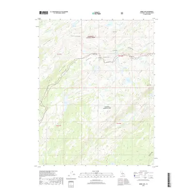
2018 Map of Kibbie Lake
USGS Topo · Published 2018About this map
Yosemite National Park and the Stanislaus National Forest meet in this high Sierra landscape, divided by a boundary that passes through the waters of Kibbie Lake. The topography is defined by significant granite elevations including Mercur Peak, Gillett Mtn, and Bartlett Peak, which overlook the deep incision of Cherry Creek Canyon. Water is the dominant force throughout the quadrangle, with drainages like Kibbie Cr, Frog Cr, and Kendrick Cr feeding numerous alpine basins such as Laurel Lake, Flora Lake, and Spotted Fawn Lake. A network of backcountry routes, including the Huckleberry Trail and various Forest Service trails, provides the primary means of movement through the wilderness. From the high point of Styx Pass to the damp reaches of Lord Meadow, the map illustrates a complex alpine ecosystem where drainage patterns and ridgelines like Kibbie Ridge dictate the passage of modern travelers and historic explorers alike.
Find a feature on this map
39 named features on this map. Tap any name to fly to it.
Don’t see what you’re looking for? This feature index may not catch every label — zoom into the map to look around manually.
Map Details
Editions of this 2018 Kibbie Lake Map
This is the sole edition of this map. No revisions or reprints were ever made.
Other maps of this area

1896 · Dardanelles
USGS Topo · 1:125,000

1897 · Yosemite
USGS Topo · 1:125,000

1898 · Dardanelles
USGS Topo · 1:125,000

1900 · Yosemite
USGS Topo · 1:125,000

1903 · Yosemite
USGS Topo · 1:125,000

1909 · Yosemite
USGS Topo · 1:125,000

1947 · Mariposa
USGS Topo · 1:250,000

1948 · Walker Lake
USGS Topo · 1:250,000

1948 · Mariposa
USGS Topo · 1:250,000

1956 · Pinecrest
USGS Topo · 1:62,500