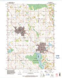
1992 Map of Kiel
USGS Topo · Published 1996About this map
Industrial and agricultural development near the Calumet and Manitowoc county line characterizes this region during the 1990s. The manufacturing hub of Kiel and the nearby city of New Holstein are the primary centers of activity, linked by the Wisconsin Central railroad. Outside these urban centers, the landscape is defined by the expansive Kiel Marsh State Wildlife Area, where the Sheboygan River meanders through wetland terrain. Genealogists will find a high density of burial sites including SS Peter and Paul Cemetery, Schleswig Cemetery, and Holy Rosary Cemetery. The map also captures smaller rural junctions such as St Anna, Steinthal, and Meggers, alongside evidence of local industry at the Quarry on Lime Kiln Road and various gravel pits.
Find a feature on this map
54 named features on this map. Tap any name to fly to it.
Don’t see what you’re looking for? This feature index may not catch every label — zoom into the map to look around manually.
Map Details
Editions of this 1992 Kiel Map
This is the sole edition of this map. No revisions or reprints were ever made.
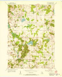
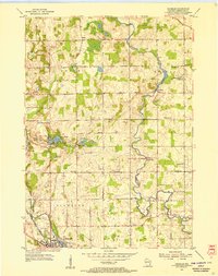
Other maps of this area
1954 · School Hill
USGS Topo · 1:24,000

1954 · Howards Grove
USGS Topo · 1:62,500

1954 · Chilton
USGS Topo · 1:62,500

1954 · Reedsville
USGS Topo · 1:62,500
1954 · Franklin
USGS Topo · 1:24,000

1954 · Kiel
USGS Topo · 1:62,500

1954 · Milwaukee
USGS Topo · 1:250,000

1954 · Manitowoc
USGS Topo · 1:250,000

1955 · Green Bay
USGS Topo · 1:250,000

1957 · Madison
USGS Topo · 1:250,000