2023 Map of Kilbourne
USGS Topo · Published 2023About this map
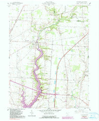
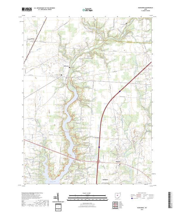
Alum Creek and its expansive reservoir basin dominate this central Ohio landscape, carving a north-south path through Delaware County. The settlement of Kilbourne sits at the northern end of this corridor, where the Old Kilbourne Cem and Green Mound Cem mark the long-standing heritage of the local community. To the south, the village of Berkshire remains centered near the Berkshire Cem, while the northern outskirts of Sunbury begin to appear along the lower margin. The topography is defined by numerous drainage runs, including Salt Well Run, Slate Lick, and Johnson Run, which feed into the primary waterway. Transportation patterns are anchored by the north-south corridor of Interstate 71 and arterial routes like Us Rte 42. Smaller landmarks such as Bohannan Airport and the secluded Littles Springs provide specific points of interest for local historians and genealogists studying the evolution of these rural townships.
Find a feature on this map
98 named features on this map. Tap any name to fly to it.
Don’t see what you’re looking for? This feature index may not catch every label — zoom into the map to look around manually.
Map Details
Editions of this 2023 Kilbourne Map
This is the sole edition of this map. No revisions or reprints were ever made.