2022 Map of Kildare
USGS Topo · Published 2022About this map
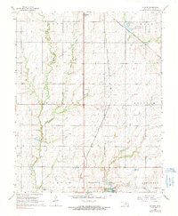
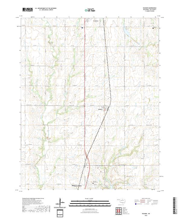
The northern edge of Ponca City and the small town of Kildare anchor this central Kay County landscape, showing the transition from municipal outskirts to the agricultural plains of northern Oklahoma. The layout is defined by the rigid section-line road grid, including Kildare Rd and W Doolin Ave, which cut across a prairie drained by a network of seasonal streams. The winding courses of Bois d'Arc Cr and Turkey Cr create the only breaks in the geometric terrain. To the north, the southern limits of Newkirk appear, while the presence of Wolf Creek Cem and Resthaven Memorial Park provides specific points of interest for genealogists tracing family histories in the region. Two numbered water bodies, 071026 Reservoir and 071027 Reservoir, suggest localized water management in an area dominated by cattle ranching and wheat farming.
Find a feature on this map
57 named features on this map. Tap any name to fly to it.
Don’t see what you’re looking for? This feature index may not catch every label — zoom into the map to look around manually.
Map Details
Editions of this 2022 Kildare Map
This is the sole edition of this map. No revisions or reprints were ever made.