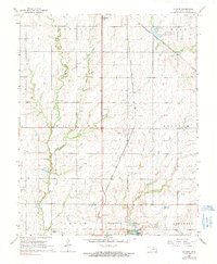
1968 Map of Kildare
USGS Topo · Published 1991About this map
Kildare and the surrounding townships in Kay County are defined by a mix of agricultural land and industrial energy development during the late 1960s. The northern reaches of Ponca City extend onto this sheet, where suburban growth meets the recreational waters of West Lake Ponca and Lake Ponca Park. Central to the area’s economic identity is the Northwest Kildare Oil and Gas Field, marked by numerous well sites.
Find a feature on this map
25 named features on this map. Tap any name to fly to it.
Don’t see what you’re looking for? This feature index may not catch every label — zoom into the map to look around manually.
Map Details
Editions of this 1968 Kildare Map
2 editions found
Other maps of this area

1935 · Kaw
USGS Topo · 1:62,500

1936 · Belford
USGS Topo · 1:62,500

1955 · Enid
USGS Topo · 1:250,000

1958 · Enid
USGS Topo · 1:250,000

1963 · Charley Creek
USGS Topo · 1:24,000

1963 · Uncas
USGS Topo · 1:24,000

1963 · Kaw City NW
USGS Topo · 1:24,000

1968 · Ponca City NW
USGS Topo · 1:24,000
1968 · Newkirk
USGS Topo · 1:24,000

1968 · Kildare
USGS Topo · 1:24,000