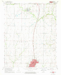
1968 Map of Newkirk
USGS Topo · Published 1970About this map
Newkirk serves as the focal point of this late 1960s landscape, situated just south of the border between Kansas Oklahoma. The town layout is clearly defined, featuring the St Francis Sch, a Courthouse, and Lions Park. To the north, the Chilocco Indian School occupies a significant campus along Chilocco Creek, complete with its own reservoir system and a nearby Historical Monument marking the state line.
Find a feature on this map
27 named features on this map. Tap any name to fly to it.
Don’t see what you’re looking for? This feature index may not catch every label — zoom into the map to look around manually.
Map Details
Editions of this 1968 Newkirk Map
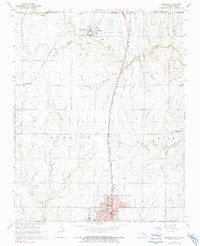
2 editions found
Other maps of this area

1889 · Burden
USGS Topo · 1:125,000

1890 · Wellington
USGS Topo · 1:125,000

1935 · Kaw
USGS Topo · 1:62,500

1955 · Wichita
USGS Topo · 1:250,000

1955 · Enid
USGS Topo · 1:250,000

1958 · Enid
USGS Topo · 1:250,000

1958 · Wichita
USGS Topo · 1:250,000

1963 · Uncas
USGS Topo · 1:24,000

1963 · Kaw City NW
USGS Topo · 1:24,000

1965 · Silverdale
USGS Topo · 1:24,000