
1958 Map of Enid
USGS Topo · Published 1958About this map
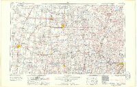
The Arkansas River and its major tributaries, the Salt Fork Arkansas River and Cimarron River, carve a winding path through the northern Oklahoma prairie, defining a landscape of agriculture and intensive petroleum extraction. The energy economy of the late 1950s is highly visible through massive operations such as the Cushing Oil Field, Burbank Oil Field, and Garber Oil Field, which are networked by pumping stations and grain elevators along the Atchison Topeka and Santa Fe Railway. Significant institutional footprints include the Osage Indian Reservation, centered around Pawhuska and the Osage Indian Agency, and the sprawling Chilocco Indian Agricultural School near the Kansas border.
Find a feature on this map
201 named features on this map. Tap any name to fly to it.
Don’t see what you’re looking for? This feature index may not catch every label — zoom into the map to look around manually.
Map Details
Editions of this 1958 Enid Map
2 editions found
Other maps of this area

1885 · Sedan
USGS Topo · 1:125,000

1886 · Independence
USGS Topo · 1:125,000

1889 · Burden
USGS Topo · 1:125,000

1889 · Anthony
USGS Topo · 1:125,000

1889 · Sedan
USGS Topo · 1:125,000

1889 · Caldwell
USGS Topo · 1:125,000

1890 · Wellington
USGS Topo · 1:125,000

1891 · Anthony
USGS Topo · 1:125,000

1892 · Guthrie
USGS Topo · 1:62,500

1892 · Kingfisher
USGS Topo · 1:125,000