
1889 Map of Sedan
USGS Topo · Published 1889About this map
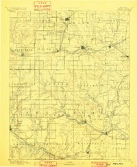
Sedan serves as a prominent focal point in this late nineteenth-century survey, situated at the junction of developing rail lines and river valleys. The landscape is defined by the winding course of the Elk River and Big Caney Creek, where early Kansas settlements like Moline, Grenola, and Elk Falls were established along the expanding rail networks. The presence of the Atchison Topeka and Santa Fe Railroad and the Denver Memphis and Atlantic Railroad highlights the era's rapid industrial connectivity, linking rural townships such as Belleville and Lafayette. This map offers a detailed view of the regional geography before modern highway systems, showing the relationship between water sources like Turkey Creek and the placement of remote outposts such as Cloverdale and Boston. Genealogists will find interest in the distinct township boundaries and the early locations of smaller settlements like Wauneta and Chautauqua Springs.
Find a feature on this map
69 named features on this map. Tap any name to fly to it.
Don’t see what you’re looking for? This feature index may not catch every label — zoom into the map to look around manually.
Map Details
Editions of this 1889 Sedan Map
4 editions found
Other maps of this area

1885 · Eureka
USGS Topo · 1:125,000

1885 · Sedan
USGS Topo · 1:125,000

1886 · Fredonia
USGS Topo · 1:125,000

1886 · Independence
USGS Topo · 1:125,000

1888 · Eureka
USGS Topo · 1:125,000

1888 · Eldorado
USGS Topo · 1:125,000

1889 · Burden
USGS Topo · 1:125,000

1894 · Fredonia
USGS Topo · 1:125,000

1894 · Independence
USGS Topo · 1:125,000

1894 · Eureka
USGS Topo · 1:125,000