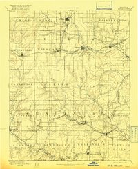
1889 Map of Sedan
USGS Topo · Published 1916About this map
Sedan and the surrounding townships of southern Kansas appear here during a period of rapid westward rail expansion in the late nineteenth century. The Elk River carves through the northern landscape, while a dense network of watercourses like Caney Creek and Salt Creek define the rugged topography of the Chautauqua Hills. The map captures the significant role of early railroads in shaping these settlements, with the Denver Memphis and Atlantic Railroad cutting through the center and the Atchison Topeka and Santa Fe Railroad connecting northern towns like Howard and Moline. Local history is preserved in the placement of small communities such as Boston and Cloverdale, many of which were established as vital supply points for ranching and early commerce before the turn of the century. The southern edge is defined by the Kansas Oklahoma Boundary Line, marking the limit of the state just north of Elgin.
Find a feature on this map
66 named features on this map. Tap any name to fly to it.
Don’t see what you’re looking for? This feature index may not catch every label — zoom into the map to look around manually.
Map Details
Editions of this 1889 Sedan Map
4 editions found
Other maps of this area

1885 · Eureka
USGS Topo · 1:125,000

1885 · Sedan
USGS Topo · 1:125,000

1886 · Fredonia
USGS Topo · 1:125,000

1886 · Independence
USGS Topo · 1:125,000

1888 · Eureka
USGS Topo · 1:125,000

1888 · Eldorado
USGS Topo · 1:125,000

1889 · Burden
USGS Topo · 1:125,000

1889 · Sedan
USGS Topo · 1:125,000

1894 · Fredonia
USGS Topo · 1:125,000

1894 · Independence
USGS Topo · 1:125,000