Old Maps of Chautauqua County, Kansas
Explore 172 old maps of Chautauqua County, spanning from 1885 to today. These high-resolution historic maps reveal how streets, neighborhoods, landmarks, and natural features evolved over time — perfect for genealogy, metal detecting, research, and local history exploration.
What you can do with these maps:
- See how Chautauqua County changed over time: Compare historical maps to modern-day views to trace roads, homesites, rail lines & more.
- View detailed metadata: Each map includes creators, publishers, year, scale, and archive source.
- Overlay maps with satellite & LiDAR: Visualize the past alongside modern tools to explore terrain & human change.
- Trusted historical sources: Maps sourced from the USGS, Library of Congress, and other archives.
- Access maps your way: View online, download high-res files, or order prints for personal or research use.
Start exploring old maps of Chautauqua County to uncover forgotten places, hidden landmarks, and the deep history beneath your feet.
Chautauqua County, KS maps
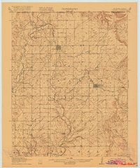
(172)- 1885 Map of Sedan, 1960 Print
 1885 Sedan1960 Print · USGSSoutheast Kansas during the 1880s rail boom shows a landscape of emerging prairie towns and expanding iron rails. Genealogists and local historians can trace the early rail layouts of the Atchison Topeka and Santa Fe Railroad through Elk Falls and Longton, or find long-established rural centers like Wauneta and Boston.
 - 1886 Map of Independence
 1886 Independence1886 Print · USGSSoutheastern Kansas is captured here in the mid-1880s as the railroad network began to reshape the prairie landscape. Genealogists and researchers can trace the early foundations of Independence, Cherryvale, and Coffeyville, or locate smaller places like Radical City and La Fontaine.
 - 1889 Map of Burden
 1889 Burden1889 Print · USGSCowley County was at the height of its railroad-driven expansion in the 1880s, becoming a vital corridor for three major lines. Researchers can trace the early layouts of Winfield, Burden, and Dexter alongside long-lost railroad stops like Torrance.6 unique versions available
 - 1889 Map of Sedan
 1889 Sedan1889 Print · USGSSoutheastern Kansas in the late nineteenth century is captured here as the railroad era transformed the prairie. Researchers can trace early township developments and the paths of the Denver Memphis and Atlantic Railroad through towns like Sedan, Grenola, and Cedar Vale.4 unique versions available
 - 1894 Map of Independence
 1894 Independence1894 Print · USGSSoutheast Kansas comes alive in the late nineteenth century as a major railroad junction before the turn of the century. Genealogists and historians can trace early settlements like Radical City, Sternerton, and Harrisonville, or locate family sites near Table Mound.
 - 1901 Map of Nowata
 1901 Nowata1901 Print · USGSThe Cherokee Nation in Indian Territory is captured here at the start of the twentieth century, showing the lands that would soon become northeast Oklahoma. Researchers can trace early rail-town growth in Nowata and Bartlesville or locate smaller settlements like Alluwe and Coodys Bluff.2 unique versions available
 - 1905 Map of Independence
 1905 Independence1905 Print · USGSSoutheastern Kansas at the turn of the century is a landscape of expanding rail-hubs and river commerce. Genealogists can trace early homesteads and rail-stops like Lafontaine, Havana, and Sycamore, or locate family landmarks near Table Mound and the Verdigris River.4 unique versions available
 - 1909 Map of Pawhuska, 1957 Print
 1909 Pawhuska1957 Print · USGSOsage County comes alive in this turn-of-the-century survey of the terrain around Pawhuska and its neighboring rail towns. Trace the paths of three major railroads as they pass through Barnsdall, find landmarks like Daltons Caves, or locate the White Swan Ford.
 - 1910 Map of Pawhuska
 1910 Pawhuska1910 Print · USGSOsage County's landscape at the dawn of Oklahoma statehood reveals a transition from tribal lands to a rail-connected economy. Genealogists and historians can trace early settlements like Wynona and Bigheart, or find local landmarks like Daltons Caves and White Swan Ford.2 unique versions available
 - 1914 Map of Nowata
 1914 Nowata1914 Print · USGSNortheastern Oklahoma at the height of its early statehood growth is documented here as the railroad network expanded across the Verdigris River valley. Genealogists can locate dozens of country schools like Go-back School and vanished post offices such as Avelia Wayside PO.5 unique versions available
 - 1916 Map of Foraker
 1916 Foraker1916 Print · USGSNorthern Osage County is captured here just before the First World War, showing the ranching and rail landscape of the Oklahoma-Kansas border. Family historians can locate rural landmarks like Red Eagle School, Grainola, and the Midland Valley railroad.2 unique versions available
 - 1947 Map of Joplin, 1954 Print
 1947 Joplin1954 Print · USGSThe borderlands of Missouri, Kansas, and Oklahoma are shown here during the late 1940s, a period of heavy industrial and military activity. Researchers can trace the extensive Tri-State Mining District, the layout of Camp Crowder, and local landmarks like Mount Hope Cem.
 - 1949 Map of Joplin
 1949 Joplin1949 Print · USGSThe Kansas-Missouri borderlands thrive in the late 1940s, showing a robust network of railroad towns and river valleys. Researchers can trace historic rail lines like the Missouri Pacific RR and locate rural centers such as Chanute, Iola, and Fort Scott.
 - 1954 Map of Tulsa
 1954 Tulsa1954 Print · USGSNortheast Oklahoma and the Ozark border are shown here during a period of massive industrial and infrastructure growth. Researchers can trace the legacy of the Tri-State Mining District and the development of major reservoirs like Grand Lake O' The Cherokees.2 unique versions available
 - 1954 Map of Joplin, 1967 Print
 1954 Joplin1967 Print · USGSThe tri-state border region of Kansas, Missouri, and Oklahoma is captured here during a peak era of mid-century industrial and agricultural activity. Researchers can trace family history through dozens of rural cemeteries or locate landmarks like the Kansas Army Ammunition Plant and Pittsburg State University.3 unique versions available
 - 1955 Map of Wichita, 1959 Print
 1955 Wichita1959 Print · USGSSouth-central Kansas comes alive in the mid-1950s as Wichita grows into its role as a regional industrial and military powerhouse. Trace the rail-and-river network connecting El Dorado and Arkansas City through the Atchison Topeka and Santa Fe lines.3 unique versions available
 - 1955 Map of Enid, 1966 Print
 1955 Enid1966 Print · USGSNorth-central Oklahoma's transition from open plains to the blackjack hills of the Osage Indian Reservation is captured in the mid-1950s. Researchers can trace the development of the Naval Reserve Oil Field, the grounds of Vance AFB, and the early footprints of Tulsa and Stillwater.4 unique versions available
 - 1958 Map of Enid
 1958 Enid1958 Print · USGSNorthern Oklahoma is mapped here in the late fifties, showcasing a dense network of petroleum production and historic tribal lands. Researchers can trace the legacy of the Osage Indian Reservation, early energy hubs like the Cushing Oil Field, and the Chilocco Indian Agricultural School.2 unique versions available
 - 1958 Map of Wichita
 1958 Wichita1958 Print · USGSSouth Central Kansas in the late fifties was a landscape of aviation industry, oil exploration, and expanding turnpikes. Researchers can trace mid-century growth through McConnell Air Force Base, major facilities for Cessna Aircraft Company, and the active El Dorado Oil Field.
 - 1958 Map of Joplin
 1958 Joplin1958 Print · USGSThe tri-state border region of Missouri, Kansas, and Oklahoma is shown during the late fifties, a time of heavy rail traffic and mining activity. Local historians can trace the industrial landscape through the Joplin & Pittsburg Ry or locate family sites like Zion Ch and Bender Mounds.
 - 1958 Map of Tulsa, 1968 Print
 1958 Tulsa1968 Print · USGSNortheast Oklahoma and the Ozark borderlands are captured here during a massive era of reservoir construction and highway expansion. Researchers can trace the mid-century footprints of Tulsa, the sprawling Lake O' the Cherokees, and historical sites like Pea Ridge National Military Park.3 unique versions available
 - 1959 Map of Joplin
 1959 Joplin1959 Print · USGSThe Tri-State region’s mining and rail-driven economy is on full display in the late fifties. Genealogists can locate Lead and Zinc Mines near Joplin, family markers at Oak Hill Cem, and military history at Camp Clark.
 - 1961 Map of Caney, 1963 Print
 1961 Caney1963 Print · USGSMontgomery County was a landscape of rail-driven commerce and emerging industry in the early sixties. Genealogists and local historians can trace the Old Indian Treaty Boundary, the Sunny Side Cem, and mid-century relics like the Drive-in Theater.3 unique versions available
 - 1962 Map of Oak Valley, 1963 Print
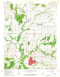
 1962 Oak Valley1963 Print · USGSElk County and Chautauqua County rural life is captured here in the early sixties, centered on the Elk River and rail corridors. Genealogists and researchers can locate the Crum Cem, trace the Atchison Topeka and Santa Fe River line, or explore the streets of Longton and Oak Valley.2 unique versions available
 - 1962 Map of Cedar Vale West, 1963 Print
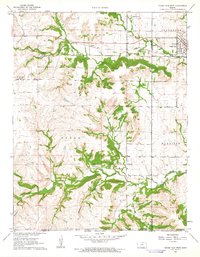 1962 Cedar Vale West1963 Print · USGSCowley County in the early 1960s reveals a landscape shaped by rail, ranching, and the legacy of the Old Indian Treaty Boundary. Genealogists and historians can trace family roots through the Cedar Creek Cem or locate the industrial footprint of local Oil Wells and the Missouri Pacific line.2 unique versions available
Showing maps 1-25 of 172
Top cities of Chautauqua County
- Sedan historical maps
- Cedar Vale historical maps
- Peru historical maps
- Niotaze historical maps
- Chautauqua historical maps
- Elgin historical maps
Frequently asked questions
- What are the different types of historical maps available for Chautauqua County?
- What is the oldest map of Chautauqua County?
- Where can I purchase historical maps of Chautauqua County for my home or office?
- Where can I download high-res historical maps of Chautauqua County?
- Are there historical topographic maps available for Chautauqua County?
- Is there historical aerial imagery available for Chautauqua County?
- Where are historical maps of Chautauqua County sourced from?