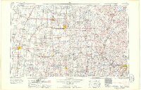
1958 Map of Enid
USGS Topo · Published 1958About this map
The Osage Indian Reservation dominates the eastern half of this mid-century landscape, a region defined by the convergence of the Arkansas River and Cimarron River. The map reveals an intensive petroleum economy, with numerous production zones including the Burbank Oil Field and the Naval Reserve Oil Field interspersed among the grazing lands and valleys. To the west, the city of Enid serves as a major hub, anchored by Vance Air Force Base.
Find a feature on this map
162 named features on this map. Tap any name to fly to it.
Don’t see what you’re looking for? This feature index may not catch every label — zoom into the map to look around manually.
Map Details
Editions of this 1958 Enid Map
2 editions found

Other maps of this area

1885 · Sedan
USGS Topo · 1:125,000

1886 · Independence
USGS Topo · 1:125,000

1889 · Burden
USGS Topo · 1:125,000

1889 · Anthony
USGS Topo · 1:125,000

1889 · Sedan
USGS Topo · 1:125,000

1889 · Caldwell
USGS Topo · 1:125,000

1890 · Wellington
USGS Topo · 1:125,000

1891 · Anthony
USGS Topo · 1:125,000

1892 · Guthrie
USGS Topo · 1:62,500

1892 · Kingfisher
USGS Topo · 1:125,000