
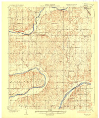
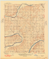
1936 Map of Belford
USGS Topo · Published 1936About this map
The Arkansas River meanders through this landscape on the borders of Kay, Osage, Noble, and Pawnee counties, defining the early 20th-century rural geography of north-central Oklahoma. This 1930s-era survey reveals a densely distributed network of country schools, such as Enterprise Sch, North Doga Sch, and Pa-He Sch, reflecting the localized rural educational structure prior to widespread district consolidation.
Find a feature on this map
51 named features on this map. Tap any name to fly to it.
Don’t see what you’re looking for? This feature index may not catch every label — zoom into the map to look around manually.
Map Details
Editions of this 1936 Belford Map
3 editions found
Other maps of this area

1916 · Foraker
USGS Topo · 1:62,500

1929 · Skedee
USGS Topo · 1:62,500

1930 · Pawnee
USGS Topo · 1:62,500

1931 · Skedee
USGS Topo · 1:62,500

1932 · Fairfax
USGS Topo · 1:62,500

1935 · Kaw
USGS Topo · 1:62,500

1936 · Pawnee
USGS Topo · 1:62,500

1955 · Enid
USGS Topo · 1:250,000

1958 · Enid
USGS Topo · 1:250,000

1963 · Charley Creek
USGS Topo · 1:24,000