
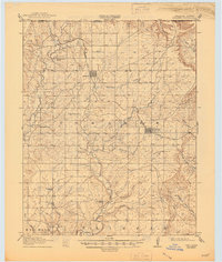
1916 Map of Foraker
USGS Topo · Published 1916About this map
Grainola and Foraker anchor this northern Osage County landscape just before the regional oil boom shifted the local economy. The terrain is defined by the Midland Valley corridor, where the railroad of the same name provided a critical connection for cattle shipping and agriculture across the undulating prairie. A dense network of rural infrastructure is visible, particularly the numerous local school districts that served the scattered homesteads of the era. Genealogists can identify the exact locations of the Red Eagle School, Brooks School, and Hay Creek School, which were the social hearts of these early Oklahoma communities. The map also details a complex drainage system including Salt Creek and Antelope Creek, illustrating the natural water sources that dictated the placement of the first ranching headquarters and early farmsteads in the Foraker and Big Hill townships.
Find a feature on this map
30 named features on this map. Tap any name to fly to it.
Don’t see what you’re looking for? This feature index may not catch every label — zoom into the map to look around manually.
Map Details
Editions of this 1916 Foraker Map
2 editions found
Other maps of this area

1885 · Sedan
USGS Topo · 1:125,000

1889 · Burden
USGS Topo · 1:125,000

1889 · Sedan
USGS Topo · 1:125,000

1909 · Pawhuska
USGS Topo · 1:125,000

1910 · Pawhuska
USGS Topo · 1:125,000

1932 · Fairfax
USGS Topo · 1:62,500

1935 · Kaw
USGS Topo · 1:62,500

1936 · Belford
USGS Topo · 1:62,500

1955 · Wichita
USGS Topo · 1:250,000

1955 · Enid
USGS Topo · 1:250,000