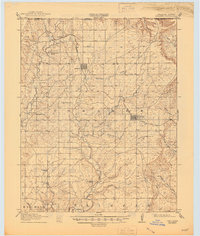
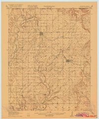
1916 Map of Foraker
USGS Topo · Published 1945About this map
Midland Valley rail lines connect the small settlements of Osage County in this survey conducted just before the United States entered the First World War. The landscape is defined by an extensive network of rural education, featuring numerous family and locally named schoolhouses such as Red Eagle School, Beaver Creek School, and Brooks School distributed across the prairie. The town of Foraker serves as a primary hub along the railroad, while smaller outposts like Grainola and Frankfort mark the northern reaches near the Kansas border. The drainage patterns of Salt Creek and its many tributaries, including Dugout Creek and Potato Creek, illustrate the complex topography of the Big Hill region. This map captures a specific moment in Oklahoma's early statehood when the local economy was deeply tied to these rail-side cattle and grain shipping points.
Find a feature on this map
30 named features on this map. Tap any name to fly to it.
Don’t see what you’re looking for? This feature index may not catch every label — zoom into the map to look around manually.
Map Details
Editions of this 1916 Foraker Map
2 editions found
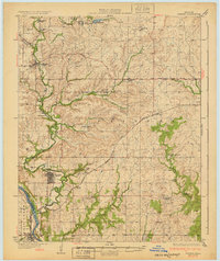
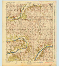
Other maps of this area

1885 · Sedan
USGS Topo · 1:125,000

1889 · Burden
USGS Topo · 1:125,000

1889 · Sedan
USGS Topo · 1:125,000

1909 · Pawhuska
USGS Topo · 1:125,000

1910 · Pawhuska
USGS Topo · 1:125,000
1916 · Foraker
USGS Topo · 1:62,500
1932 · Fairfax
USGS Topo · 1:62,500

1935 · Kaw
USGS Topo · 1:62,500
1936 · Belford
USGS Topo · 1:62,500

1955 · Wichita
USGS Topo · 1:250,000