
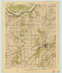
1936 Map of Pawnee
USGS Topo · Published 1936About this map
The Arkansas River marks the northern boundary of this 1930s landscape, where the convergence of industrial pumping stations and rural educational life defines the region. The Pawnee Indian School Reservation sits prominently at the eastern edge of Pawnee, serving as a central landmark alongside the Old Town Trading Post. This era shows a dense network of school districts, including the uniquely named Star A Star Sch and Skedee Valley Sch, reflecting a settled agricultural community before the consolidation of rural Oklahoma schools.
Find a feature on this map
56 named features on this map. Tap any name to fly to it.
Don’t see what you’re looking for? This feature index may not catch every label — zoom into the map to look around manually.
Map Details
Editions of this 1936 Pawnee Map
2 editions found
Other maps of this area

1893 · Stillwater
USGS Topo · 1:62,500

1929 · Yale
USGS Topo · 1:62,500

1929 · Ripley
USGS Topo · 1:62,500

1929 · Skedee
USGS Topo · 1:62,500

1930 · Pawnee
USGS Topo · 1:62,500

1931 · Skedee
USGS Topo · 1:62,500

1932 · Yale
USGS Topo · 1:62,500

1932 · Ripley
USGS Topo · 1:62,500

1932 · Fairfax
USGS Topo · 1:62,500

1936 · Belford
USGS Topo · 1:62,500