
1931 Map of Skedee
USGS Topo · Published 1931About this map
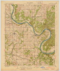
The Arkansas River meanders through this section of northern Oklahoma, forming a sharp oxbow at Souters Bend and serving as the boundary between Fairfax and Blackburn townships. Surveyed in the late 1920s, the landscape is defined by its rural density, featuring a high concentration of country schools such as Sorghum Ford Sch, Sunny Slope Sch, and Daisy Sch that served the dispersed farming families of Pawnee and Osage counties.
Find a feature on this map
63 named features on this map. Tap any name to fly to it.
Don’t see what you’re looking for? This feature index may not catch every label — zoom into the map to look around manually.
Map Details
Editions of this 1931 Skedee Map
3 editions found
Other maps of this area

1909 · Pawhuska
USGS Topo · 1:125,000

1910 · Pawhuska
USGS Topo · 1:125,000

1912 · Hominy
USGS Topo · 1:125,000

1915 · Hominy
USGS Topo · 1:125,000

1915 · Hominy
USGS Topo · 1:62,500

1929 · Yale
USGS Topo · 1:62,500

1929 · Ripley
USGS Topo · 1:62,500

1929 · Skedee
USGS Topo · 1:62,500

1930 · Pawnee
USGS Topo · 1:62,500

1932 · Yale
USGS Topo · 1:62,500