Loading...
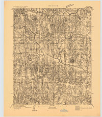
Loading map...1893 Map of Stillwater
USGS Topo · Published 1893About this map
Stillwater emerges as a developing grid-pattern town in this late nineteenth-century survey, conducted shortly after the land runs opened this region to non-Indigenous settlement. The landscape is defined by the Indian Meridian, which serves as a primary surveying baseline for the surrounding township and range blocks. To the north, the boundary for the Cherokee Outlet marks a significant historical division in Oklahoma Territory, bordering Noble and Payne counties.
Find a feature on this map
11 named features on this map. Tap any name to fly to it.
Don’t see what you’re looking for? This feature index may not catch every label — zoom into the map to look around manually.
Map Details
Date Portrayed1893
Date Published1893
PublisherU.S. Geological Survey
Map TypeTopographic
Scale1:62,500
Physical Dimensions18.6 x 21.3 inches
Editions of this 1893 Stillwater Map
This is the sole edition of this map. No revisions or reprints were ever made.
Historical Maps of Stillwater Through Time
1 maps found
Featured Locations
Source Details
SourceU.S. Geological Survey
CopyrightPublic Domain