
1968 Map of Ponca City NW
USGS Topo · Published 1969About this map
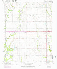
The Chikaskia River snakes through the western portion of this terrain, meeting the Arkansas River and the Salt Fork in a complex drainage system that defined the local geography during the late 1960s. The settlement of Autwine sits near the riverbanks, supported by the intersecting lines of the Atchison Topeka and Santa Fe and the Chicago Rock Island and Pacific railroads. This era saw significant petroleum activity, evidenced by the West Autwine Oil Field and the Southwest Ponca City Oil Field, with numerous oil and gas wells dotting the sections.
Find a feature on this map
28 named features on this map. Tap any name to fly to it.
Don’t see what you’re looking for? This feature index may not catch every label — zoom into the map to look around manually.
Map Details
Editions of this 1968 Ponca City NW Map
2 editions found
Other maps of this area

1955 · Enid
USGS Topo · 1:250,000

1958 · Enid
USGS Topo · 1:250,000

1968 · Tonkawa SE
USGS Topo · 1:24,000

1968 · Marland
USGS Topo · 1:24,000

1968 · Ponca City SE
USGS Topo · 1:24,000

1968 · Tonkawa
USGS Topo · 1:24,000

1968 · Kildare
USGS Topo · 1:24,000

1968 · Blackwell
USGS Topo · 1:24,000
1968 · Newkirk SW
USGS Topo · 1:24,000
1968 · Ponca City
USGS Topo · 1:24,000