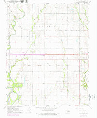
1968 Map of Ponca City NW
USGS Topo · Published 1979About this map
The Chikaskia River and Arkansas River converge at the southern edge of this territory, framing a landscape defined by both the Indian Meridian and a robust petroleum industry. The Three Sands Oil Field and numerous oil wells dot the terrain, illustrating the region's mid-century economic reliance on fossil fuels. In the village of Autwine, the rail lines of the Atchison Topeka and Santa Fe and the Chicago Rock Island and Pacific crisscross, marking a critical transport hub for the era. Local community life is rooted at Antwine Lake, Finley Sch, and Union Sch, while the Round Grove Cem stands as a quiet marker of the area's genealogical history. The presence of the Salt Fork river at the southwestern corner further emphasizes the importance of these waterways to the local topography and settlement patterns.
Find a feature on this map
36 named features on this map. Tap any name to fly to it.
Don’t see what you’re looking for? This feature index may not catch every label — zoom into the map to look around manually.
Map Details
Editions of this 1968 Ponca City NW Map
2 editions found
Other maps of this area

1955 · Enid
USGS Topo · 1:250,000

1958 · Enid
USGS Topo · 1:250,000

1968 · Tonkawa SE
USGS Topo · 1:24,000

1968 · Marland
USGS Topo · 1:24,000

1968 · Ponca City NW
USGS Topo · 1:24,000

1968 · Ponca City SE
USGS Topo · 1:24,000

1968 · Tonkawa
USGS Topo · 1:24,000

1968 · Kildare
USGS Topo · 1:24,000

1968 · Blackwell
USGS Topo · 1:24,000
1968 · Newkirk SW
USGS Topo · 1:24,000