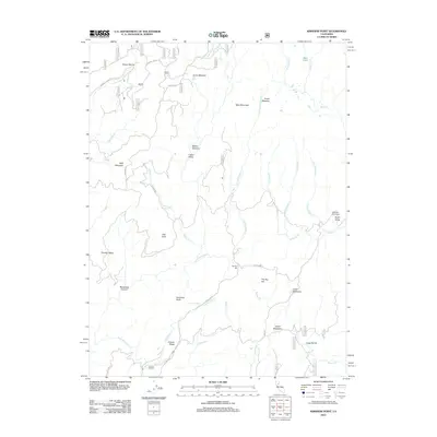
2012 Map of Kimshew Point
USGS Topo · Published 2012About this map
Kimshew Point rises as a prominent landmark in this high-elevation landscape of Butte County, defined by a complex network of seasonal creeks and mountain meadows. The terrain is structured by massive features like Table Mountain and Bald Mountain, while the human footprint is primarily marked by forest roads such as Concow Rd and Cow Camp Rd. These routes connect remote outposts and grazing areas, including the Campbell Cow Camp and Ramsey Bar. Water sources are numerous, with Little Kimshew Cr and Keyser Cr draining through steep ravines like Long Ravine and Breakneck Canyon. The presence of several named meadows, such as Logue Meadows and Millers Meadow, indicates a landscape historically utilized for summer range and timber access, punctuated by isolated water features like Granite Spring and the small Bear Lake in the northeastern corner.
Find a feature on this map
39 named features on this map. Tap any name to fly to it.
Don’t see what you’re looking for? This feature index may not catch every label — zoom into the map to look around manually.
Map Details
Editions of this 2012 Kimshew Point Map
This is the sole edition of this map. No revisions or reprints were ever made.
Other maps of this area

1886 · Lassen Peak
USGS Topo · 1:250,000

1888 · Bidwell Bar
USGS Topo · 1:125,000

1891 · Bidwell Bar
USGS Topo · 1:125,000

1891 · Chico
USGS Topo · 1:125,000

1892 · Lassen Peak
USGS Topo · 1:250,000

1893 · Chico
USGS Topo · 1:125,000

1893 · Bidwell Bar
USGS Topo · 1:125,000

1894 · Lassen Peak
USGS Topo · 1:250,000

1895 · Bidwell Bar
USGS Topo · 1:125,000

1895 · Chico
USGS Topo · 1:125,000