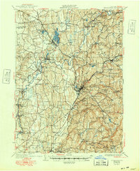
1949 Map of Kinderhook
USGS Topo · Published 1949About this map
The Martin Van Buren Homestead and the Ichabod Crane Sch anchor this landscape south of Kinderhook, reflecting the deep literary and political heritage of Columbia County. The terrain is defined by the winding course of Kinderhook Creek, which powered early industry at sites like Stuyvesant Falls and Arnolds Mill. This mid-century survey reveals a dense network of transportation, where the Albany Post Road intersects with the steel rails of the Boston and Albany and the Rutland railroads.
Find a feature on this map
86 named features on this map. Tap any name to fly to it.
Don’t see what you’re looking for? This feature index may not catch every label — zoom into the map to look around manually.
Map Details
Editions of this 1949 Kinderhook Map
This is the sole edition of this map. No revisions or reprints were ever made.
Other maps of this area

1885 · Sheffield
USGS Topo · 1:62,500

1888 · Sheffield
USGS Topo · 1:62,500

1888 · Berlin
USGS Topo · 1:62,500

1888 · Pittsfield
USGS Topo · 1:62,500

1890 · Pittsfield
USGS Topo · 1:62,500

1890 · Berlin
USGS Topo · 1:62,500

1891 · Sheffield
USGS Topo · 1:62,500

1893 · Troy
USGS Topo · 1:62,500

1893 · Coxsackie
USGS Topo · 1:62,500

1893 · Sheffield
USGS Topo · 1:62,500