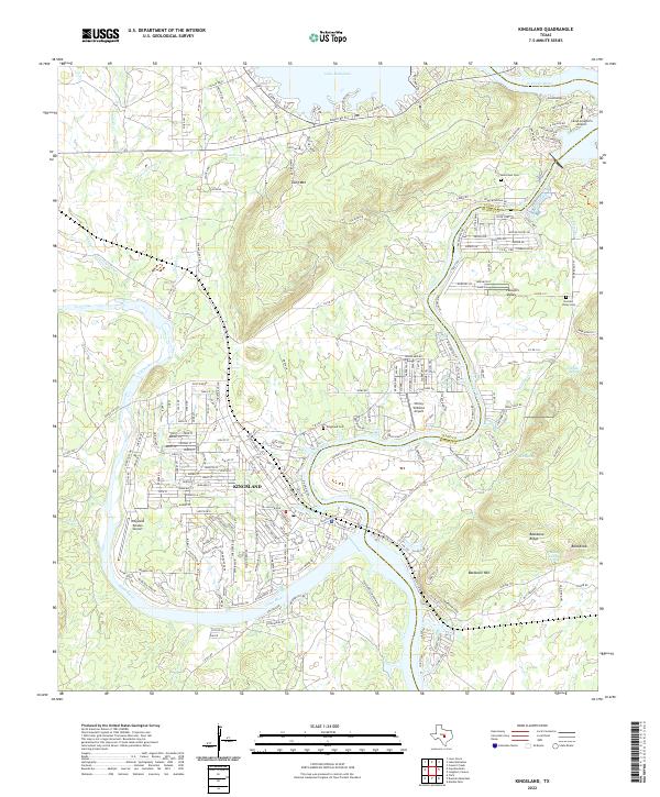
2022 Map of Kingsland
USGS Topo · Published 2022About this map
The confluence of the Llano River and the Colorado River defines this Central Texas landscape, where the town of Kingsland sits at the water's edge. This modern survey illustrates the intricate residential development of Kingsland Estates and the surrounding Hill Country terrain. While much of the area reflects recent growth, older roots are preserved at Murchison Cem and Hoovers Valley Cem. The topography is marked by prominent elevations like Backbone Ridge and Long Mountain, which rise above the river valleys. Aviation plays a notable role in the local infrastructure, with multiple facilities including Shirley Williams Airport and Camp Longhorn Airport serving the area. Natural water features like Boil Spring and Kingsland Lake contrast with the larger reservoirs, providing a detailed look at the hydrology of the Burnet and Llano county line.
Find a feature on this map
220 named features on this map. Tap any name to fly to it.
Don’t see what you’re looking for? This feature index may not catch every label — zoom into the map to look around manually.
Map Details
Editions of this 2022 Kingsland Map
This is the sole edition of this map. No revisions or reprints were ever made.
Other maps of this area

1887 · Llano
USGS Topo · 1:125,000

1887 · Burnet
USGS Topo · 1:125,000

1893 · Burnet
USGS Topo · 1:125,000

1894 · Llano
USGS Topo · 1:125,000

1903 · Burnet
USGS Topo · 1:125,000

1904 · Llano
USGS Topo · 1:125,000

1909 · Llano
USGS Topo · 1:125,000

1909 · Burnet
USGS Topo · 1:125,000

1918 · Llano
USGS Topo · 1:125,000

1925 · Burnet 3-b
USGS Topo · 1:48,000