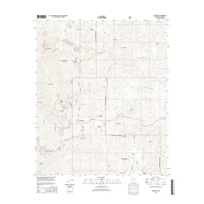
2013 Map of Kingston
USGS Topo · Published 2013About this map
Kingston sits at the foot of the Mimbres Mountains in this early 21st-century study of Sierra County's high desert. The town's grid, including Main St and Water St, is positioned along Middle Percha Cr, reflecting a settlement pattern dictated by the drainage of the surrounding Gila National Forest. The landscape is dominated by complex water management and topographic markers, from the heights of Star Peak and Sherman Mtn to the numerous livestock tanks like Basin Tank and Starvation Tank that dot the canyons. The presence of numerous unnamed numbered markers suggests a landscape heavily surveyed for resource management or mining claims. This record documents the enduring geography of a mountain community where deep drainages like Southwest Canyon and Ladron Gulch converge, and primitive routes like FDR 157 navigate the terrain long after the region's initial mining booms.
Find a feature on this map
68 named features on this map. Tap any name to fly to it.
Don’t see what you’re looking for? This feature index may not catch every label — zoom into the map to look around manually.
Map Details
Editions of this 2013 Kingston Map
This is the sole edition of this map. No revisions or reprints were ever made.
Other maps of this area

1935 · Hillsboro
USGS Topo · 1:48,000

1940 · Hillsboro
USGS Topo · 1:62,500

1954 · Tularosa
USGS Topo · 1:250,000

1955 · Las Cruces
USGS Topo · 1:250,000

1956 · San Lorenzo
USGS Topo · 1:62,500

1958 · Las Cruces
USGS Topo · 1:250,000

1958 · Tularosa
USGS Topo · 1:250,000

1963 · Bell Mountain
USGS Topo · 1:24,000

1963 · Victoria Park
USGS Topo · 1:24,000

1963 · Apache Peak
USGS Topo · 1:24,000