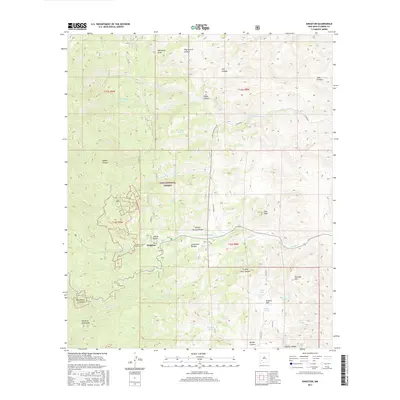
2017 Map of Kingston
USGS Topo · Published 2017About this map
Kingston serves as the primary settlement on this landscape, its residential grid centered on Main St and Ladron Gulch. The area is defined by the high elevations of the Mimbres Mountains and the sprawling expanse of the Gila National Forest, where steep canyons and seasonal water sources dictate the layout of human activity. The drainage of Middle Percha Cr and S Percha Cr cuts through the terrain, creating deep topographic features like Southwest Canyon and Drummond Canyon. Local infrastructure revolves around land management and water access, evidenced by numerous tanks such as Starvation Tank and Boundary Tank scattered among the peaks of Sherman Mtn and Star Peak. This 2017 edition preserves the footprint of a mountain community where the rugged western geography of Sierra County meets forestry and ranching history.
Find a feature on this map
46 named features on this map. Tap any name to fly to it.
Don’t see what you’re looking for? This feature index may not catch every label — zoom into the map to look around manually.
Map Details
Editions of this 2017 Kingston Map
This is the sole edition of this map. No revisions or reprints were ever made.
Other maps of this area

1935 · Hillsboro
USGS Topo · 1:48,000

1940 · Hillsboro
USGS Topo · 1:62,500

1954 · Tularosa
USGS Topo · 1:250,000

1955 · Las Cruces
USGS Topo · 1:250,000

1956 · San Lorenzo
USGS Topo · 1:62,500

1958 · Las Cruces
USGS Topo · 1:250,000

1958 · Tularosa
USGS Topo · 1:250,000

1963 · Bell Mountain
USGS Topo · 1:24,000

1963 · Victoria Park
USGS Topo · 1:24,000

1963 · Apache Peak
USGS Topo · 1:24,000