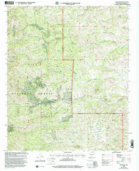
1999 Map of Kingston
USGS Topo · Published 2002About this map
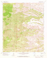
Kingston serves as the focal point of this terrain, situated at the confluence of the Mimbres Mountains and the drainage systems of Middle Percha Creek and its many tributaries. The area's mining legacy is evident through numerous Prospects and named operations like the Gray Eagle Mine, illustrating the intense mineral exploration that characterized this section of the Gila National Forest. Beyond industrial markings, the settlement includes a local Cem, an Athletic Field, and the Kingston Work Center, which includes a dedicated Heliport. The eastern slopes of the range are deeply incised by canyons such as Sawpit Canyon and Dumm Canyon, while the western edge transitions into the protected Aldo Leopold Wilderness. This 1990s revision reveals a landscape where historical mining activity and modern forest management infrastructure exist alongside landmarks like the Wind Charger Communication Tower.
Find a feature on this map
48 named features on this map. Tap any name to fly to it.
Don’t see what you’re looking for? This feature index may not catch every label — zoom into the map to look around manually.
Map Details
Editions of this 1999 Kingston Map
This is the sole edition of this map. No revisions or reprints were ever made.
Other maps of this area
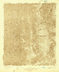
1935 · Hillsboro
USGS Topo · 1:48,000
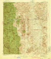
1940 · Hillsboro
USGS Topo · 1:62,500

1954 · Tularosa
USGS Topo · 1:250,000

1955 · Las Cruces
USGS Topo · 1:250,000
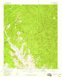
1956 · San Lorenzo
USGS Topo · 1:62,500

1958 · Las Cruces
USGS Topo · 1:250,000

1958 · Tularosa
USGS Topo · 1:250,000

1963 · Bell Mountain
USGS Topo · 1:24,000

1963 · Victoria Park
USGS Topo · 1:24,000
1963 · Apache Peak
USGS Topo · 1:24,000