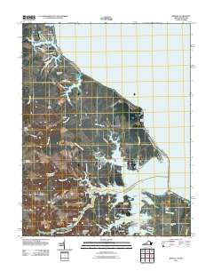
2011 Map of Kinsale
USGS Topo · Published 2011About this map
Kinsale sits at the heart of this coastal Virginia landscape, where the Yeocomico River system branches into numerous creeks and protected harbors. The map reveals a deeply indented shoreline defined by points and necks, such as Pecatone Neck and Mondays Neck, which have historically dictated the local maritime economy and settlement patterns. Established landings like Hudsons Landing and Hampton Hall Landing emphasize the area's continued reliance on water access.
Find a feature on this map
78 named features on this map. Tap any name to fly to it.
Don’t see what you’re looking for? This feature index may not catch every label — zoom into the map to look around manually.
Map Details
Editions of this 2011 Kinsale Map
This is the sole edition of this map. No revisions or reprints were ever made.
Other maps of this area

1892 · Piney Point
USGS Topo · 1:62,500

1894 · Piney Point
USGS Topo · 1:62,500

1894 · Point Lookout
USGS Topo · 1:62,500

1895 · Nomini
USGS Topo · 1:125,000

1895 · Piney Point
USGS Topo · 1:62,500

1898 · Nomini
USGS Topo · 1:125,000

1898 · St. Marys
USGS Topo · 1:125,000

1901 · Piney Point
USGS Topo · 1:62,500

1906 · St. Marys
USGS Topo · 1:125,000

1912 · Point Lookout
USGS Topo · 1:62,500