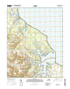
2016 Map of Kinsale
USGS Topo · Published 2016About this map
The Yeocomico River system dominates this coastal Virginia landscape, where the Maryland and Virginia state line meets the Potomac River. The settlement of Kinsale serves as a focal point along the West Yeocomico River, surrounded by several historic necks and points that define the region's irregular shoreline. In the southern portion of the quadrangle, the community of Harryhogan and the smaller Harryhogan Point sit near the confluence of the river branches, highlighting the area's deep connection to maritime navigation. Genealogists can identify localized landmarks such as Carmel Cem, Bailey Cem, and the historic Hampton Hall Bridge. The presence of Shivok Airport and Gardy Millpond further illustrates the mix of 21st-century infrastructure and long-standing water-based industry that characterizes this part of the Northern Neck.
Find a feature on this map
123 named features on this map. Tap any name to fly to it.
Don’t see what you’re looking for? This feature index may not catch every label — zoom into the map to look around manually.
Map Details
Editions of this 2016 Kinsale Map
This is the sole edition of this map. No revisions or reprints were ever made.
Other maps of this area

1892 · Piney Point
USGS Topo · 1:62,500

1894 · Piney Point
USGS Topo · 1:62,500

1894 · Point Lookout
USGS Topo · 1:62,500

1895 · Nomini
USGS Topo · 1:125,000

1895 · Piney Point
USGS Topo · 1:62,500

1898 · Nomini
USGS Topo · 1:125,000

1898 · St. Marys
USGS Topo · 1:125,000

1901 · Piney Point
USGS Topo · 1:62,500

1906 · St. Marys
USGS Topo · 1:125,000

1912 · Point Lookout
USGS Topo · 1:62,500