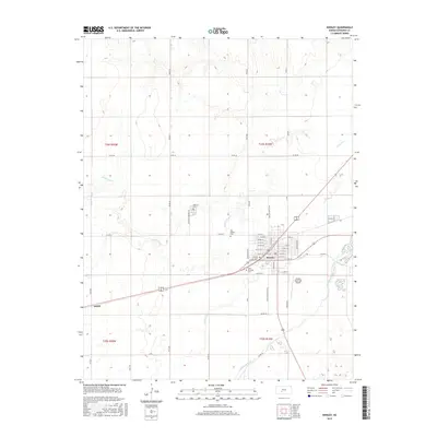
2015 Map of Kinsley
USGS Topo · Published 2015About this map
Kinsley serves as the focal point of this Edwards County survey, situated at the convergence of several regional transportation routes and the winding path of Coon Cr. The town's grid is well-established, with thoroughfares like Massachusetts Ave and Winchester Ave defining the residential and commercial layout. A distinctive cluster of local history is visible in the placement of cemeteries surrounding the town center, including Hillside Cem to the north, Old Kinsley Cem just west of the grid, and Saint Nicholas Cem to the south along Winchester Ave. To the west, the small settlement of Ardell sits along the rail corridor. The southern portion of the map is dominated by the broad course of the Arkansas River, which flows past the Kinsley Municipal Airport, illustrating the relationship between the area's natural hydrology and modern infrastructure development.
Find a feature on this map
51 named features on this map. Tap any name to fly to it.
Don’t see what you’re looking for? This feature index may not catch every label — zoom into the map to look around manually.
Map Details
Editions of this 2015 Kinsley Map
This is the sole edition of this map. No revisions or reprints were ever made.
Other maps of this area

1889 · Larned
USGS Topo · 1:125,000

1889 · Kinsley
USGS Topo · 1:125,000

1891 · Larned
USGS Topo · 1:125,000

1892 · Ness
USGS Topo · 1:125,000

1892 · Kinsley
USGS Topo · 1:125,000

1892 · Spearville
USGS Topo · 1:125,000

1894 · Spearville
USGS Topo · 1:125,000

1894 · Kinsley
USGS Topo · 1:125,000

1894 · Ness
USGS Topo · 1:125,000

1955 · Great Bend
USGS Topo · 1:250,000