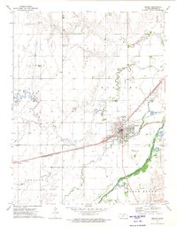
1972 Map of Kinsley
USGS Topo · Published 1974About this map
The Arkansas River and the Atchison Topeka and Santa Fe railroad corridor define the geography of this Edwards County landscape. The city of Kinsley serves as the regional hub, situated at the confluence of several transport routes and the winding path of Coon Creek. The map documents a well-developed agricultural and civic infrastructure, including the Kinsley Municipal Airport and several local burial grounds such as Hillside Cem and St Nicholas Cem.
Find a feature on this map
24 named features on this map. Tap any name to fly to it.
Don’t see what you’re looking for? This feature index may not catch every label — zoom into the map to look around manually.
Map Details
Editions of this 1972 Kinsley Map
This is the sole edition of this map. No revisions or reprints were ever made.
Other maps of this area

1889 · Larned
USGS Topo · 1:125,000

1889 · Kinsley
USGS Topo · 1:125,000

1891 · Larned
USGS Topo · 1:125,000

1892 · Ness
USGS Topo · 1:125,000

1892 · Kinsley
USGS Topo · 1:125,000

1892 · Spearville
USGS Topo · 1:125,000

1894 · Spearville
USGS Topo · 1:125,000

1894 · Kinsley
USGS Topo · 1:125,000

1894 · Ness
USGS Topo · 1:125,000

1955 · Great Bend
USGS Topo · 1:250,000