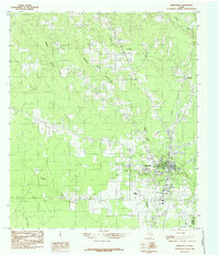
1984 Map of Kirbyville
USGS Topo · Published 1985About this map
Kirbyville serves as the focal point of this East Texas survey, revealing the town's layout and surrounding timberlands in the mid-1980s. Situated near the Jasper Co Newton Co line, the settlement is defined by a traditional grid oriented toward the railway and local drainages. The landscape is intensely hydrological, characterized by a dense network of winding waterways including Boggy Creek, Trout Creek, and Slaydons Creek that carve through the piney woods. To the north, the small community of Bon Ami is identified, reflecting the region's history of lumbering and rural settlement. The presence of Kirbyville Airport south of the main town site highlights the infrastructure supporting this corner of Jasper County, while numerous family-named landmarks like Nichols Creek and Robinson Branch offer specific points of interest for local historians and genealogists tracing the geographic footprint of area residents during this era.
Find a feature on this map
13 named features on this map. Tap any name to fly to it.
Don’t see what you’re looking for? This feature index may not catch every label — zoom into the map to look around manually.
Map Details
Editions of this 1984 Kirbyville Map
This is the sole edition of this map. No revisions or reprints were ever made.
Other maps of this area

1952 · Lake Charles
USGS Topo · 1:250,000

1954 · Lake Charles
USGS Topo · 1:250,000

1954 · Beaumont
USGS Topo · 1:250,000

1955 · Roganville
USGS Topo · 1:62,500

1955 · Curtis
USGS Topo · 1:62,500

1957 · Beaumont
USGS Topo · 1:250,000

1958 · Spurger
USGS Topo · 1:62,500

1958 · Kirbyville
USGS Topo · 1:62,500

1984 · Beaumont
USGS Topo · 1:250,000

1984 · Potato Patch Lake
USGS Topo · 1:24,000