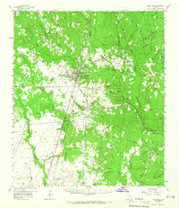
1958 Map of Kirbyville
USGS Topo · Published 1966About this map
The town of Kirbyville serves as the focal point of this East Texas survey, situated at the junction of the Gulf Colorado and Santa Fe and the A T & S F railroads. This era of the late 1950s finds the region deeply intertwined with the timber and youth recreation industries, evidenced by the presence of the E O Siecke State Forest and nearby organizational grounds such as Camp Otanyao and Camp Bill Stark.
Find a feature on this map
71 named features on this map. Tap any name to fly to it.
Don’t see what you’re looking for? This feature index may not catch every label — zoom into the map to look around manually.
Map Details
Editions of this 1958 Kirbyville Map
2 editions found

Other maps of this area

1935 · Wilson Lake
USGS Topo · 1:31,680

1947 · Carter Creek
USGS Topo · 1:31,680

1947 · Wilson Lake
USGS Topo · 1:31,680

1949 · Bancroft
USGS Topo · 1:31,680

1952 · Lake Charles
USGS Topo · 1:250,000

1954 · Lake Charles
USGS Topo · 1:250,000

1954 · Beaumont
USGS Topo · 1:250,000

1955 · Roganville
USGS Topo · 1:62,500

1955 · Silsbee
USGS Topo · 1:62,500

1955 · Bessmay
USGS Topo · 1:62,500