
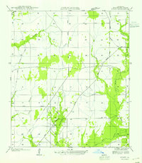
1947 Map of Carter Creek
USGS Topo · Published 1947About this map
The Sabine River forms a winding western boundary for this Louisiana-Texas borderlands landscape, defining a terrain of oxbow lakes and dense riparian marsh. Meandering loops have created a string of named water bodies including Carter Lake, Alligator Lake, and Big Eddy Lake, which sit alongside the active river channel. Moving inland, the survey reveals a transition from these wetlands into upland areas marked by the traces of the regional timber industry. Numerous stretches of an Old Logging Railroad Grade cut through the forest, intersecting with State Highway No 143 and State Highway No 287. Local social landmarks such as Duetts Ch and Clarks Cem appear near the drainage of Shoats Creek, providing key points of reference for genealogists and researchers of the Beauregard and Calcasieu Parish line.
Find a feature on this map
20 named features on this map. Tap any name to fly to it.
Don’t see what you’re looking for? This feature index may not catch every label — zoom into the map to look around manually.
Map Details
Editions of this 1947 Carter Creek Map
This is the sole edition of this map. No revisions or reprints were ever made.
Other maps of this area

1947 · Starks
USGS Topo · 1:31,680

1947 · Hyatt
USGS Topo · 1:31,680

1947 · Lunita
USGS Topo · 1:31,680

1947 · Long Marsh
USGS Topo · 1:31,680

1949 · Bancroft
USGS Topo · 1:31,680

1952 · Lake Charles
USGS Topo · 1:250,000

1954 · Lake Charles
USGS Topo · 1:250,000
1955 · Hyatt
USGS Topo · 1:31,680

1955 · Bessmay
USGS Topo · 1:62,500

1958 · Kirbyville
USGS Topo · 1:62,500