
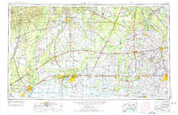
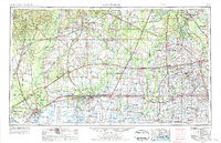
1954 Map of Lake Charles
USGS Topo · Published 1964About this map
Lake Charles serves as the industrial and logistical anchor for this Southwest Louisiana landscape during a mid-century period of intense petroleum development. The map reveals an intricate network of specialized resource extraction, where countless sites like the Sulphur Mines Oil Field and Starks Oil and Gas Field dot the prairie and marshland. These energy hubs are interconnected by a robust transportation grid, including the Intracoastal Waterway and major rail lines such as the Southern Pacific and Kansas City Southern.
Find a feature on this map
160 named features on this map. Tap any name to fly to it.
Don’t see what you’re looking for? This feature index may not catch every label — zoom into the map to look around manually.
Map Details
Editions of this 1954 Lake Charles Map
3 editions found
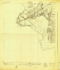
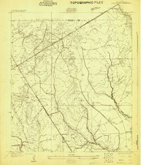
Other maps of this area

1926 · Terry
USGS Topo · 1:24,000

1926 · Lakeview
USGS Topo · 1:24,000
1926 · Vidor
USGS Topo · 1:24,000

1926 · Texla
USGS Topo · 1:24,000
1926 · Mauriceville
USGS Topo · 1:24,000

1932 · Lake Charles NE
USGS Topo · 1:31,680

1932 · Moss Lake
USGS Topo · 1:31,680

1932 · Abbeville NE
USGS Topo · 1:31,680

1932 · Beaumont
USGS Topo · 1:62,500

1932 · Lake Charles NW
USGS Topo · 1:31,680