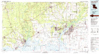
1986 Map of Lake Charles
USGS Topo · Published 1988About this map
Lake Charles and the surrounding Calcasieu Parish landscape are defined by an intricate network of waterways and industrial infrastructure in the mid-1980s. The Calcasieu Ship Channel and Intracoastal Waterway facilitate heavy transit through the marshy terrain of Black Lake and Grand Lake, connecting the city to the Gulf. Industrial hubs like Brimstone and Sulphur reflect the region's mineral-driven economy, while the sprawling Chennault Air Base and Municipal Airport emphasize its importance as a regional transportation node.
Find a feature on this map
122 named features on this map. Tap any name to fly to it.
Don’t see what you’re looking for? This feature index may not catch every label — zoom into the map to look around manually.
Map Details
Editions of this 1986 Lake Charles Map
2 editions found
Other maps of this area

1926 · Terry
USGS Topo · 1:24,000

1926 · Lakeview
USGS Topo · 1:24,000

1926 · Vidor
USGS Topo · 1:24,000

1926 · Texla
USGS Topo · 1:24,000

1926 · Mauriceville
USGS Topo · 1:24,000

1932 · Lake Charles NE
USGS Topo · 1:31,680

1932 · Moss Lake
USGS Topo · 1:31,680

1932 · Beaumont
USGS Topo · 1:62,500

1932 · Lake Charles NW
USGS Topo · 1:31,680

1932 · Orange
USGS Topo · 1:62,500