
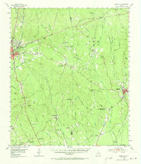
1955 Map of Roganville
USGS Topo · Published 1956About this map
Jasper and Newton serve as the principal hubs in this mid-century survey of the East Texas timberlands. The landscape is defined by the Gulf Colorado and Santa Fe (AT & SF) railroad corridor, which links smaller settlements like Roganville and Blox to the larger county seats. Social life in the 1950s is centered around rural institutions such as Jamestown Church, Farrs Chapel, and the East Texas Baptist Encampment. Evidence of the area's transition appears in the notation of the Clare Creek School (Aband), while the rise of modern infrastructure is marked by the Radio Station (KTXJ) and Steers Stadium in Jasper. Between the creeks, including White Oak Creek and Big Cow Creek, numerous family-named burial grounds like McConnico Cemetery and Boyett Cemetery provide valuable data for genealogical research.
Find a feature on this map
71 named features on this map. Tap any name to fly to it.
Don’t see what you’re looking for? This feature index may not catch every label — zoom into the map to look around manually.
Map Details
Editions of this 1955 Roganville Map
2 editions found
Other maps of this area

1935 · Wilson Lake
USGS Topo · 1:31,680

1944 · Wiergate
USGS Topo · 1:62,500

1947 · Wilson Lake
USGS Topo · 1:31,680

1948 · Wiergate
USGS Topo · 1:62,500

1952 · Lake Charles
USGS Topo · 1:250,000

1953 · Alexandria
USGS Topo · 1:250,000

1953 · Palestine
USGS Topo · 1:250,000

1954 · Wiergate
USGS Topo · 1:24,000

1954 · Wiergate
USGS Topo · 1:62,500

1954 · Lake Charles
USGS Topo · 1:250,000