
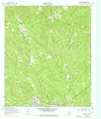
1954 Map of Wiergate
USGS Topo · Published 1958About this map
Wiergate and Burkeville anchor the southern reaches of this 1950s Newton County landscape, where the local economy was shifting away from the heavy timber rail operations of previous decades. A prominent Dismantled railroad bisects the terrain, tracing a north-south path through the timbered hills and across numerous drainages like Bear Branch and Little Cow Creek. This corridor once served the regional lumber industry, and its path remains a primary structural feature of the rural landscape.
Find a feature on this map
25 named features on this map. Tap any name to fly to it.
Don’t see what you’re looking for? This feature index may not catch every label — zoom into the map to look around manually.
Map Details
Editions of this 1954 Wiergate Map
2 editions found
Other maps of this area

1944 · Wiergate
USGS Topo · 1:62,500

1948 · Wiergate
USGS Topo · 1:62,500

1949 · Evans
USGS Topo · 1:31,680

1952 · Lake Charles
USGS Topo · 1:250,000

1953 · Alexandria
USGS Topo · 1:250,000

1954 · Wiergate SE
USGS Topo · 1:24,000

1954 · Fairdale
USGS Topo · 1:24,000

1954 · Wiergate
USGS Topo · 1:62,500
1954 · Haddens
USGS Topo · 1:24,000

1954 · Lake Charles
USGS Topo · 1:250,000