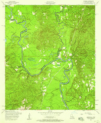
1954 Map of Haddens
USGS Topo · Published 1958About this map
The Sabine River snakes through this 1954 landscape, serving as the primary boundary between Texas and Louisiana. This survey captures a river-bottom environment characterized by oxbow lakes and sloughs, such as Horseshoe Lake, Alligator Lake, and Crossway Slough. Local settlement is sparse, concentrated near small centers like Toledo and Haddens, with much of the western bank dedicated to the Sabine National Forest.
Find a feature on this map
44 named features on this map. Tap any name to fly to it.
Don’t see what you’re looking for? This feature index may not catch every label — zoom into the map to look around manually.
Map Details
Editions of this 1954 Haddens Map
3 editions found
Other maps of this area

1941 · Leesville
USGS Topo · 1:62,500

1942 · Florien
USGS Topo · 1:62,500

1943 · Leesville
USGS Topo · 1:62,500

1944 · Negreet
USGS Topo · 1:62,500

1944 · Wiergate
USGS Topo · 1:62,500

1944 · Florien
USGS Topo · 1:62,500

1946 · Leesville
USGS Topo · 1:62,500

1948 · Leesville
USGS Topo · 1:62,500

1948 · Wiergate
USGS Topo · 1:62,500

1953 · Alexandria
USGS Topo · 1:250,000