
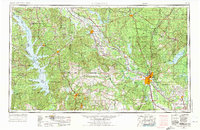
1953 Map of Alexandria
USGS Topo · Published 1963About this map
The Red River carves a diagonal path through Central Louisiana, serving as the primary geographic axis for major settlements like Alexandria, Natchitoches, and Colfax. This mid-century landscape is defined by the extensive reaches of the Kisatchie National Forest and a complex network of waterways, including the expansive Catahoula Lake and the Sabine River along the western border. The map reveals the heavy military footprint in the region, centered on the Fort Polk Military Reservation, Camp Beauregard, and England Air Force Base. Industrial and transport patterns are visible through the convergence of the Kansas City Southern Railway and Texas and Pacific Railway lines, which supported the timber and agricultural economies of parishes such as Natchitoches and Rapides. Smaller towns like Winnfield, Many, and Marksville anchor the rural areas, connected by an emerging post-war highway system that includes U.S. Highway 71 and U.S. Highway 165.
Find a feature on this map
192 named features on this map. Tap any name to fly to it.
Don’t see what you’re looking for? This feature index may not catch every label — zoom into the map to look around manually.
Map Details
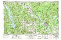
Editions of this 1953 Alexandria Map
3 editions found
Other maps of this area

1932 · Colfax NE
USGS Topo · 1:31,680

1932 · Boyce NE
USGS Topo · 1:31,680

1932 · Boyce SW
USGS Topo · 1:31,680

1932 · Colfax SW
USGS Topo · 1:31,680

1932 · Colfax SE
USGS Topo · 1:31,680

1932 · Colfax NW
USGS Topo · 1:31,680

1935 · Hagewood
USGS Topo · 1:31,680

1935 · Pawnee
USGS Topo · 1:31,680

1935 · Verda
USGS Topo · 1:31,680

1935 · Turkey Creek
USGS Topo · 1:62,500