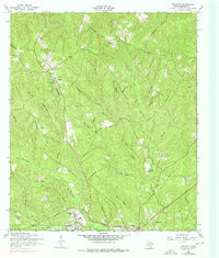
1954 Map of Wiergate
USGS Topo · Published 1976About this map
Wiergate and Burkeville anchor the southern reaches of this landscape, reflecting a mid-century East Texas timber and rural economy. The presence of a Dismantled railroad snaking through the center of the sheet indicates the shifting transportation infrastructure of the era, as former logging lines were abandoned in favor of improved roads and a new Pipeline. The area is characterized by a dense network of watercourses, including Little Cow Creek and Royal Creek, which feed into the wider basin.
Find a feature on this map
33 named features on this map. Tap any name to fly to it.
Don’t see what you’re looking for? This feature index may not catch every label — zoom into the map to look around manually.
Map Details
Editions of this 1954 Wiergate Map
2 editions found
Other maps of this area

1944 · Wiergate
USGS Topo · 1:62,500

1948 · Wiergate
USGS Topo · 1:62,500

1949 · Evans
USGS Topo · 1:31,680

1952 · Lake Charles
USGS Topo · 1:250,000

1953 · Alexandria
USGS Topo · 1:250,000

1954 · Wiergate
USGS Topo · 1:24,000

1954 · Wiergate SE
USGS Topo · 1:24,000

1954 · Fairdale
USGS Topo · 1:24,000

1954 · Wiergate
USGS Topo · 1:62,500
1954 · Haddens
USGS Topo · 1:24,000