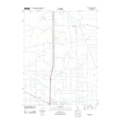
2012 Map of Kirkwood
USGS Topo · Published 2012About this map
Kirkwood and the smaller settlements of Wyo and Cory anchor this rural landscape in the northern Sacramento Valley. The map documents an area defined by sophisticated water management, featuring the Tehama Colusa Canal, the Lemon Home Colony Canal, and the Stony Creek Irrigation Canal which feed the surrounding agricultural fields. Local industry is clearly marked by the presence of energy resources, specifically the Kirkwood Gas Field and the Rice Creek Gas Field near the northern boundary.
Find a feature on this map
77 named features on this map. Tap any name to fly to it.
Don’t see what you’re looking for? This feature index may not catch every label — zoom into the map to look around manually.
Map Details
Editions of this 2012 Kirkwood Map
This is the sole edition of this map. No revisions or reprints were ever made.
Other maps of this area

1904 · Vina
USGS Topo · 1:62,500

1904 · Walker Creek
USGS Topo · 1:31,680

1906 · Willows
USGS Topo · 1:62,500

1914 · Kirkwood
USGS Topo · 1:31,680

1914 · Orland
USGS Topo · 1:31,680

1914 · Hamilton
USGS Topo · 1:31,680

1914 · McIntosh Landing
USGS Topo · 1:31,680

1919 · Fruto
USGS Topo · 1:62,500

1944 · Fruto
USGS Topo · 1:62,500

1944 · Flournoy
USGS Topo · 1:62,500