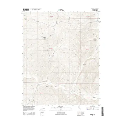
2015 Map of Knob Hill
USGS Topo · Published 2015About this map
Poso Creek carves a significant course through the southern foothills of the Sierra Nevada as it enters the San Joaquin Valley, defining the complex topography of this Kern County landscape. This 2015 survey reveals a terrain defined by steep-walled drainages such as Coffee Canyon, Hillvale Canyon, and Borel Canyon. The namesake Knob Hill stands as a prominent local landmark amidst a network of rural roads, including S Granite Rd and Round Mountain Rd. Of particular interest to local historians is the site of the Halfway House located along the northern stretch of the Granite Road corridor. The map details the transition from the upland bluffs like Mon Bluff to the flatter expanses of the Central Valley in the northwest, illustrating the physical geography that has long dictated movement and settlement patterns in this part of the county.
Find a feature on this map
38 named features on this map. Tap any name to fly to it.
Don’t see what you’re looking for? This feature index may not catch every label — zoom into the map to look around manually.
Map Details
Editions of this 2015 Knob Hill Map
This is the sole edition of this map. No revisions or reprints were ever made.
Other maps of this area

1906 · Bakersfield
USGS Topo · 1:62,500

1910 · Buena Vista Lake
USGS Topo · 1:125,000

1912 · Buena Vista Lake
USGS Topo · 1:125,000

1914 · Caliente
USGS Topo · 1:125,000

1930 · Oildale
USGS Topo · 1:31,680

1931 · Deepwell Ranch
USGS Topo · 1:31,680

1932 · North of Oildale
USGS Topo · 1:31,680

1932 · Woody
USGS Topo · 1:62,500
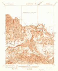
1933 · Oil Center
USGS Topo · 1:31,680

1935 · Woody
USGS Topo · 1:62,500