
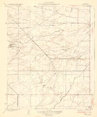
1930 Map of Oildale
USGS Topo · Published 1930About this map
Oildale and the northern outskirts of Bakersfield are captured here during a period of significant industrial and infrastructural expansion. The landscape is defined by the convergence of major rail lines like the Southern Pacific and the Atchison Topeka and Santa Fe, which serviced the burgeoning petroleum and agricultural interests of Kern County. A striking feature of this 1930 survey is the orderly grid of the Kern County Airplane Landing Field, situated just north of the Lerdo Canal. A complex network of waterways, including the Calloway Canal and the Beardsley Canal, draws from the Kern River to support the surrounding valley. Local education is well-represented by several rural institutions such as Norris Sch and Standard Sch, while small rail-side settlements like Jewetta, Oil Junction, and Seguro mark the transport hubs of the era.
Find a feature on this map
21 named features on this map. Tap any name to fly to it.
Don’t see what you’re looking for? This feature index may not catch every label — zoom into the map to look around manually.
Map Details
Editions of this 1930 Oildale Map
This is the sole edition of this map. No revisions or reprints were ever made.
Other maps of this area

1906 · Bakersfield
USGS Topo · 1:62,500

1910 · Buena Vista Lake
USGS Topo · 1:125,000

1912 · Buena Vista Lake
USGS Topo · 1:125,000

1914 · Caliente
USGS Topo · 1:125,000

1929 · Stevens
USGS Topo · 1:31,680

1929 · Fairfax School
USGS Topo · 1:31,680

1930 · Famoso
USGS Topo · 1:31,680

1930 · Rosedale
USGS Topo · 1:31,680

1932 · North of Oildale
USGS Topo · 1:31,680
1932 · Stevens
USGS Topo · 1:31,680