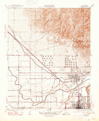
1935 Map of Oildale
USGS Topo · Published 1947About this map
Bakersfield and the neighboring community of Oildale are depicted at a pivotal moment of development in the southern San Joaquin Valley. This mid-1930s landscape is defined by the rigid grid of oil industry infrastructure and agricultural irrigation, visible in the extensive network of the Lerdo Canal, Calloway Canal, and Kern Canal. The map reveals the intersection of major transport routes, where the Southern Pacific and Atchison Topeka and Santa Fe railroads meet the Golden State Highway. Strategic landmarks such as the Kern County Landing Field and the Oil Junction settlement highlight the area's role as a regional hub for both energy production and aviation. Local education is anchored by rural institutions like Norris Sch and Fruitdale Sch, providing key reference points for genealogists researching family history in early Kern County.
Find a feature on this map
25 named features on this map. Tap any name to fly to it.
Don’t see what you’re looking for? This feature index may not catch every label — zoom into the map to look around manually.
Map Details
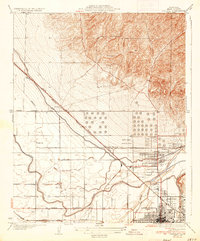
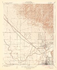
Editions of this 1935 Oildale Map
3 editions found
Other maps of this area

1906 · Bakersfield
USGS Topo · 1:62,500

1910 · Buena Vista Lake
USGS Topo · 1:125,000

1912 · Buena Vista Lake
USGS Topo · 1:125,000

1914 · Caliente
USGS Topo · 1:125,000

1929 · Stevens
USGS Topo · 1:31,680

1929 · Fairfax School
USGS Topo · 1:31,680

1930 · Famoso
USGS Topo · 1:31,680

1930 · Rosedale
USGS Topo · 1:31,680

1930 · Oildale
USGS Topo · 1:31,680

1932 · North of Oildale
USGS Topo · 1:31,680