
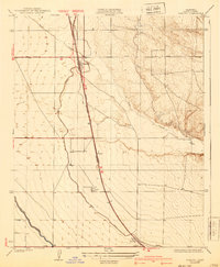
1930 Map of Famoso
USGS Topo · Published 1930About this map
The agricultural landscape of Kern County is defined here by its dependence on water and rail infrastructure at the close of the 1920s. Poso Creek winds through the northern section of the terrain, while the artificial courses of the Lerdo Canal and Calloway Canal slice across the western plains, illustrating the early efforts to irrigate this portion of the San Joaquin Valley. Settlement patterns follow the transportation spine of the Southern Pacific railroad, which runs parallel to the Golden State Highway. Small hubs such as Famoso, Slater, Kimberlina, and Dow serve as transit points for local commerce. The intersection of the Wasco Woody Road and the rail line at Famoso provides a clear picture of the region's connectivity during this era, showing how rural crossroads facilitated the movement of goods between the valley's farms and distant markets.
Find a feature on this map
12 named features on this map. Tap any name to fly to it.
Don’t see what you’re looking for? This feature index may not catch every label — zoom into the map to look around manually.
Map Details
Editions of this 1930 Famoso Map
2 editions found
Other maps of this area

1906 · Bakersfield
USGS Topo · 1:62,500

1910 · Buena Vista Lake
USGS Topo · 1:125,000

1912 · Buena Vista Lake
USGS Topo · 1:125,000

1927 · McFarland
USGS Topo · 1:31,680

1930 · McFarland
USGS Topo · 1:31,680

1930 · Wasco
USGS Topo · 1:31,680

1930 · Pond
USGS Topo · 1:31,680

1930 · Rosedale
USGS Topo · 1:31,680

1930 · Oildale
USGS Topo · 1:31,680

1931 · Deepwell Ranch
USGS Topo · 1:31,680