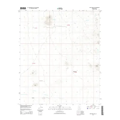
2014 Map of Koht Kohl Hill
USGS Topo · Published 2014About this map
Koht Kohl Hill rises above the arid expanse of the Aguirre Valley in this modern topographic study of the Schuk Toak District. The landscape is defined by its drainage systems and water management, with seasonal watercourses like House Wash and Aguirre Wash cutting through the desert floor toward the Roskruge Mountains. The placement of Tank One Hundred Thirteen and Tank Eighty illustrates the vital role of water storage in this ranching and tribal land environment. Small settlements including Skoksonak and Quinlin are connected by roads such as Bia-35, which navigate between prominent geological landmarks like the volcanic Cerro Negro and the distinct formation of Twin Peaks. The map provides a detailed view of the cadastral grid, showing the township and range lines that organize this portion of Pima County.
Find a feature on this map
19 named features on this map. Tap any name to fly to it.
Don’t see what you’re looking for? This feature index may not catch every label — zoom into the map to look around manually.
Map Details
Editions of this 2014 Koht Kohl Hill Map
This is the sole edition of this map. No revisions or reprints were ever made.
Other maps of this area

1934 · Tucson Mountains
USGS Topo · 1:125,000

1934 · Silver Bell
USGS Topo · 1:125,000

1938 · San Vicente
USGS Topo · 1:62,500

1941 · San Vicente
USGS Topo · 1:62,500

1941 · Cocoraque Butte
USGS Topo · 1:62,500

1942 · San Vicente
USGS Topo · 1:62,500

1943 · Cocoraque Butte
USGS Topo · 1:62,500

1948 · San Vicente
USGS Topo · 1:62,500

1956 · Tucson
USGS Topo · 1:250,000

1958 · Tucson
USGS Topo · 1:250,000
Featured Places
- Skoksonak, Schuk Toak District
- Schuk Toak District, AZ
- Quinlin, Schuk Toak District
- Pima County, AZ
- United States