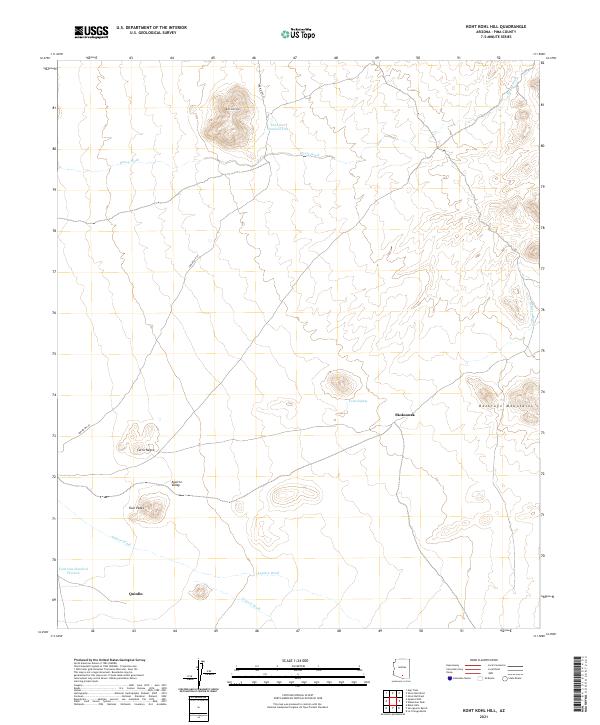
2021 Map of Koht Kohl Hill
USGS Topo · Published 2021About this map
Skoksonak and Quinlin anchor this arid landscape within the Aguirre Valley, a region defined by its seasonal drainage patterns and prominent desert peaks. The drainage network is particularly detailed, featuring the Aguirre Wash, Viopuli Wash, and House Wash, which together illustrate the hydrologic flow across this Pima County terrain. The survey captures the topographic prominence of Koht Kohl Hill to the north and the jagged heights of the Roskruge Mountains to the east. Several water tanks, such as Tank Eighty and Tank One Hundred Thirteen, suggest the pastoral or ranching infrastructure necessary in such a dry climate. Transportation is represented by the path of Indian Rte 35, providing a modern reference point for navigating the gap between Cerro Negro and the Twin Peaks.
Find a feature on this map
19 named features on this map. Tap any name to fly to it.
Don’t see what you’re looking for? This feature index may not catch every label — zoom into the map to look around manually.
Map Details
Editions of this 2021 Koht Kohl Hill Map
This is the sole edition of this map. No revisions or reprints were ever made.
Other maps of this area

1934 · Tucson Mountains
USGS Topo · 1:125,000

1934 · Silver Bell
USGS Topo · 1:125,000

1938 · San Vicente
USGS Topo · 1:62,500

1941 · San Vicente
USGS Topo · 1:62,500

1941 · Cocoraque Butte
USGS Topo · 1:62,500

1942 · San Vicente
USGS Topo · 1:62,500

1943 · Cocoraque Butte
USGS Topo · 1:62,500

1948 · San Vicente
USGS Topo · 1:62,500

1956 · Tucson
USGS Topo · 1:250,000

1958 · Tucson
USGS Topo · 1:250,000
Featured Places
- Skoksonak, Schuk Toak District
- Schuk Toak District, AZ
- Quinlin, Schuk Toak District
- Pima County, AZ
- United States