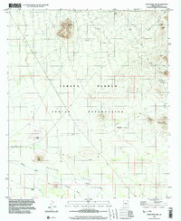
1996 Map of Koht Kohl Hill
USGS Topo · Published 2003About this map
The Tohono O'Odham Indian Reservation landscape is defined by the broad drainage of the Aguirre Valley and the sharp rises of desert peaks. While the map reflects planimetry from 1996, the presence of historical locations like Skoksonak and Quinlin provides a window into older habitation patterns within Pima County. The eastern edge of the quadrangle is marked by the Roskruge Mountains, where a Mine Shaft and several Prospect labels indicate early 20th-century mineral exploration. Prominent volcanic features such as Koht Kohl Hill, Cerro Negro, and Twin Peaks punctuate the arid terrain, while drainage from Aguirre Wash and various unnamed channels illustrates the hydraulic character of the basin. This survey documents the intersection of indigenous land, localized mining history, and the natural desert environment.
Find a feature on this map
18 named features on this map. Tap any name to fly to it.
Don’t see what you’re looking for? This feature index may not catch every label — zoom into the map to look around manually.
Map Details
Editions of this 1996 Koht Kohl Hill Map
This is the sole edition of this map. No revisions or reprints were ever made.
Other maps of this area

1934 · Tucson Mountains
USGS Topo · 1:125,000

1934 · Silver Bell
USGS Topo · 1:125,000

1938 · San Vicente
USGS Topo · 1:62,500

1941 · San Vicente
USGS Topo · 1:62,500

1941 · Cocoraque Butte
USGS Topo · 1:62,500

1942 · San Vicente
USGS Topo · 1:62,500

1943 · Cocoraque Butte
USGS Topo · 1:62,500

1948 · San Vicente
USGS Topo · 1:62,500

1956 · Tucson
USGS Topo · 1:250,000

1958 · Tucson
USGS Topo · 1:250,000
Featured Places
- Quinlin, Schuk Toak District
- Schuk Toak District, AZ
- Skoksonak, Schuk Toak District
- Pima County, AZ
- United States