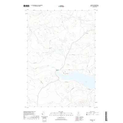
2018 Map of Kokadjo
USGS Topo · Published 2018About this map
Kokadjo serves as the central focal point of this North Woods survey, situated at the critical junction where the Roach River flows from the western tip of First Roach Pond. The landscape is defined by an intricate network of waterways and timber-management infrastructure, including the Lazy Tom Stream Reservoir and numerous drainage systems like Kidney Brook and Jewett Brook. This 2018 data illustrates the modern layout of rural connectors such as Spencer Bay Rd and Frenchtown Rd, which provide access to the interior highlands near Siras Hill. The concentration of wetlands and ponds, including Lazy Tom Pond and Jewett Pond, underscores the region's character as a primary watershed for the larger Moosehead Lake area. Settlement patterns are sparse, primarily clustered along the north shore of the pond via N Shore Rd and private ways like E Journey End.
Find a feature on this map
27 named features on this map. Tap any name to fly to it.
Don’t see what you’re looking for? This feature index may not catch every label — zoom into the map to look around manually.
Map Details
Editions of this 2018 Kokadjo Map
This is the sole edition of this map. No revisions or reprints were ever made.
Other maps of this area

1920 · Moosehead Lake
USGS Topo · 1:62,500

1922 · Moosehead Lake
USGS Topo · 1:62,500

1930 · Moosehead Lake
USGS Topo · 1:62,500

1944 · Moosehead Lake
USGS Topo · 1:62,500

1952 · First Roach Pond
USGS Topo · 1:62,500

1954 · North East Carry
USGS Topo · 1:62,500

1954 · Grant Farm
USGS Topo · 1:62,500

1954 · Millinocket
USGS Topo · 1:250,000

1957 · Moosehead Lake
USGS Topo · 1:62,500

1958 · Millinocket
USGS Topo · 1:250,000
Featured Places
- East Middlesex Canal Grant Township, ME
- Frenchtown Township, ME
- Lily Bay Township, ME
- Spencer Bay Township, ME
- T1 R13 WELS, ME